Oregon Backcountry Adventure
I hear a loud CRACK just outside the tent and bolt upright from a deep sleep. My sudden movement sends the visitor thundering away through the brush. With my heart doing double-time, my hands fumble around the tent in search of a headlamp. Once in hand, I switch it on and shine it out the mesh opening in my tent. The yellow beam of light reveals nothing but a thick forest of pine trees with dense underbrush.
It’s late July and we’re are on the first day of a motorcycle trip on the Oregon Backcountry Discovery Route (OBDR) – the start of our nine-day adventure. We’re in the Blue Mountains just southeast of Walla Walla, Washington where we arrived at the Mottet Campground after dark.
In the distance, I still hear the sound of sticks cracking and brush rustling. As the sounds get closer and I hear the animal bellowing and snorting, the type of protest a bull makes when you walk through its corral uninvited. Finally, when I feel it’s too close for comfort and I smack the tent with my hand. The visitor bolts away through the brush sounding like a deer or an elk bounding through the forest.
This scenario repeats itself a handful of times over the next few hours. By now it is 2:45am and I am rethinking my aversion to hunting wild animals. Realizing I have a few hundred miles of off-road riding to begin in a few hours, I decide to relocate. Climbing out, barefoot, I drag my tent with all of its contents about 60 feet across camp and I position it between the camp fire and picnic table. The visitor continues to protest off in the distance, but never gets close enough bother me while I again find sleep.
When morning comes, I anxiously ask my three friends if they heard the animal harassing my tent. To my chagrin, they were all fast asleep when it all happened and heard nothing. They do, however, still find ways to make deer-snorting noises for my benefit.
The animal encounter last night was a clear reminder that we are in the wild – gone are the controlled environments of civilization where humans are in charge. We are in the wilderness now, where animals, terrain and weather hold the cards. I have the epiphany that the animal last night was not the visitor, the visitor was me. With my attitude now properly adjusted, I am ready to spend the next week as a guest in this Oregon Wilderness.
The Players and Our Bikes
My cohorts on this adventure are Tom Myers, Sterling Noren and Helge Pedersen.
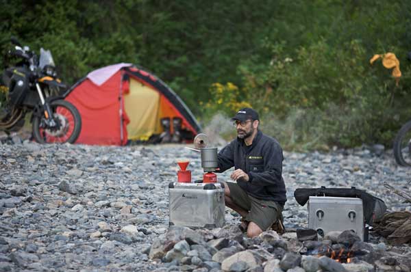
Tom is my colleague and President of Touratech-USA.
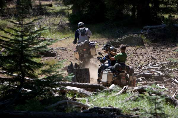
Sterling is an award winning filmmaker who specializes in documentaries on adventure motorcycling, and Helge is the founder of GlobeRiders.
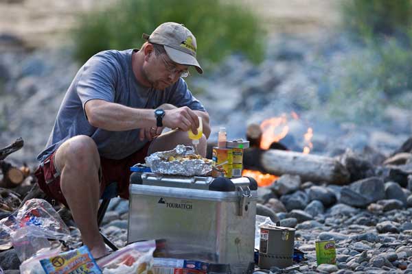
As for me, I’m the new General Manager at Touratech-USA. I have a background in the off-road motorcycle business, but am new to adventure motorcycle camping. I’m trying to absorb the expert advice from the seasoned adventure veterans who are with me for the week.
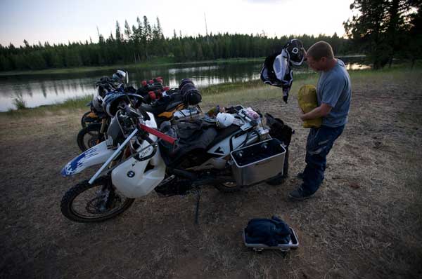
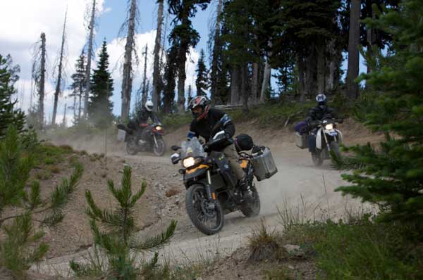
We have an assortment of BMW motorcycles including Helge’s HP2, Sterling’s R1200GS, Tom’s F800GS, and my G650X Challenge. Each of the bikes is outfitted with Zega panniers, Touratech oversized fuel tanks, and other protection items to ensure the bikes stay in good working order on this challenging terrain, Each bike is also fitted with a Garmin GPS unit secured with a Touratech locking mount.
Having ridden from Seattle the day before, our mission for the next week is to ride our motorcycles from Walla Walla, Washington to Dorris, California on a route managed by the Oregon Off-Highway Vehicle Association (OOHVA). This 1,200-mile track is what’s known as the Oregon Backcountry Discovery Route or OBDR.
Rugged Oregon Wilderness As Far as the Eye can See
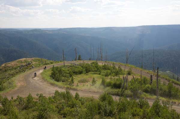
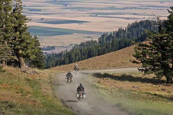
With the excitement of young children on Christmas morning, we fire up our bikes and roll out onto the dirt roads of the Blue Mountains. We are so enamored with the curvy dirt roads and beautiful vistas that we stop frequently to film and shoot photos throughout the day. The views from the lightly treed ridge tops are spectacular as they open up to a patchwork of colorful crops on the valley floor a few thousand feet below. We make a quick lunch stop at the only store and gas pump in Tollgate, OR. The stores along the OBDR are really nothing more than a gas pump with low octane fuel and a few sparse shelves of canned goods, packaged snacks and general supplies. The many photos on the walls show two things: hunting and snowmobile riding, a theme that is consistent for most of the trip.
It’s now late in the day and I find myself separated from the group after making a wrong turn, Suddenly, Helge rides by in an adjacent road, and ride off after him. I chase him on a gravel roller coaster of a road for five miles. He finally stops at the intersection to look for tire tracks and I catch up to him. He’s been searching for me, while the rest of the group waits on the correct route. By the time we reconvene, its 7:30 pm and time to make camp. The GPS shows a campground about two miles away, so we quickly head out in search of it.
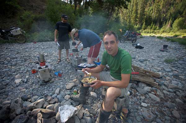
The campground is on the shore of Indian Lake, which sits at 4,000 feet elevation As we pull in, it’s obvious we have the entire campground to ourselves, so we settle in at the best spot right on the lake.
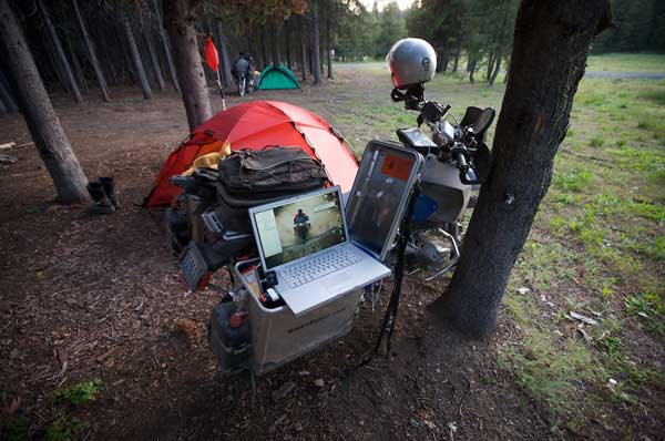
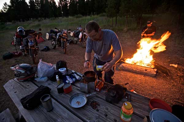
The GlobeRiders guys each unload 35 pounds of camera equipment from their respective motorcycle’s panniers. They mill around capturing the sunset ambience of our beautiful spot by the lake, and film Tom and I as we prepare clam spaghetti miles from anywhere. After evening stories around campfire, we fall asleep to the melody of coyotes howling nearby.
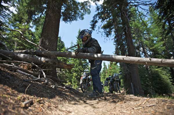
We see more deer than people in the first few days of our trip. We are deep in the wilderness, in what feels like complete isolation. There is simply no one out here, which makes me wonder how this can be Oregon. Where the people are few, the cattle guards are plenty in this area of the state. It seems like we cross in-ground metal cattle guards a dozen times per hour as we ride. With this many guards, I keep expecting ranch houses or dwellings of some kind, but I see next to none.
The OBDR is like a window into the past. Much of it is largely unchanged from the times of the pioneers, with rugged Oregon wilderness as far as the eye can see. I have the persistent feeling that we are the only humans out here.
In the first few days of the route, we are in the high mountains. It seems like every time I look at the GPS we are between 4,000 and 6,500 feet. It’s like I am riding up and down Pikes Peak several times a day. Charging up the seemingly endless corners and switchbacks of the ascent becomes more fun with each mountain pass. On a ride like this, your skills improve and your confidence builds over the days allowing you to really feel comfortable on the bike.
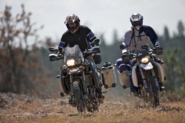
We are now 300 miles into the mostly dirt and gravel roads of the OBDR. My worries about work, home and day-to-day life are long gone. My only responsibilities are remembering to look at my GPS, to stay on track, and to keep my speed in check. We still have a long way to go, so crashing way out here would be a bad scenario for us. This trip is a perfect blend of off-road riding, campfires and good old fashion cowboy cooking with friends in the backcountry.
The River Wild and Our Good Fortune
After a few days of enjoying the predictable forest curves, the OBDR throws some excitement our way. The Malheur River flows south through the Malheur National Forest, where it crosses the OBDR route a few times. I happen to be leading our group of four when I drop down a steep, rutted road spiced with a few loose rocks. At the bottom of the hill is the primary detail I remember from internet photos of this "river of misfortune": the first and largest crossing of the Malheur. At well over 100-feet wide, the crossing has knee-deep water flowing over a bed of football-sized rock, the kind you see a fireplace constructed from in a historic lodge.
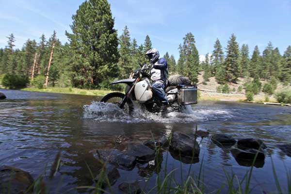
Sterling gets serious about filming and sets up his tripod and camera in the middle of the river. Standing knee-deep in the river water, boots and all, he captures us crossing the Malheur. Helge rides through the river next, without concern, and sets up his camera on the far bank. Tom rolls down into the flowing water on the F800GS and wiggles the big machine competently across the slippery rocks, to the gravel road on the other side. With my heart racing, I let out the clutch and hope for the best. I slowly wobble the G650X-Challenge through the flowing water. I bounce and bobble a bit on the slippery rocks, but somehow manage to keep the bike moving all the way to the other side. I am excited about making my longest river crossing to date, without misfortune, or even getting wet. I sense the guys are disappointed that my crossing did not yield more entertainment.
The Adrenaline Rush of Sandy Conditions and Lighting Storms
After five days of solitude in the forest, the trees slowly give way to the open range of Central Oregon. The temperature approaches 100 degrees as we drop down the steep canyon walls to Lake Billy Chinook, a reservoir oasis dotted with boats and summertime water recreation. We push on, westward, through the farmlands toward the Cascade Mountains. Within a few hours, the searing heat is displaced by clouds and the first rain drops we have encountered.
As we roll into the popular vacation town of Sisters, heavy rain is falling from ominous dark clouds. A lightning storm chases people from the busy sidewalks. We take refuge in the first real grocery store we have seen in nearly a week. We load up on food supplies and then head out through the lightning storm, on Hwy 242 toward the McKenzie Pass. Just outside of town, we see an illuminated sign that tells us the highway is closed ahead. We press on hoping that our route will take us off the highway before we get to the closure. Luck is on our side, it seems, as the GPS sends us off the highway and into the forest before the road closes. By the time we hit dirt, it’s dark and we end up on a road that is overgrown and somehow sandy. Not being used to riding in sandy conditions in my usual playground of the Cascade Mountains, it catches me off guard. Everything about the last few hours seems the antithesis of the bliss we experienced in the last 600 miles.
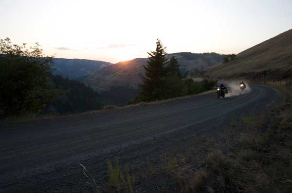
I feel the adrenaline rush of a true adventure, as we ride in darkness illuminated occasionally by lightning that seems to be coming from every direction. The trail gets steep , with nothing but sections of rock that are slippery from the rain. We ride up the mountain for another hour, but are we’re unable to find a good place to camp. We finally pitch our tents by flashlight on a foot-thick bed of pine needles next to a dead-end road.
For the first time, I am relieved to get off the bike. Going from 100 degrees, to fighting through sandy overgrown trails at night in a lightning storm really threw my body and mind for a loop. I am fatigued after a week of very long days in the saddle. Yet, despite being tired and ready for bed, I am having the time of my life on this trip.
Morning comes and we ride southbound to the base of three jagged snowcapped mountains known as The Sisters. We explore the alpine lakes in the area and enjoy some fun trail riding before finding the perfect camp location. Our spot is a picturesque alpine meadow, with a stream running through the middle. We spend the day shooting product videos and savoring the last day of camping, knowing that we will be riding home the following day.
The Journey’s End
Day nine comes and we are ready to head home. Although we intended to ride to California, we simply ran out of time. The good news is we have a great reason to come back and complete the section from Sisters, Oregon to Dorris, California.
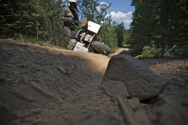
We load up the bikes and head for pavement as we start our 300-mile return trip to Seattle. Ironically, about two hours into the easy ride home Sterling’s R1200GS suffers a flat front tire, just outside the town of Madras. Fortunately Tom and I are following Sterling when this happens, so we are able to assist with the repair. After a road-side fix in the hot sun, we resume our pavement cruise north for home.
The vast Oregon Wilderness is so expansive and un-populated, it is difficult to comprehend. If you are looking to check out from civilization for a while and reconnect with the wild, the OBDR is a great way to do it.
The Route
The OBDR was the brain child of Bob and Cheryl Greenstreet according to Leonard Kerns, President of the Oregon Off-Highway Vehicle Association (OOHVA). Kern points out, "The development of route was financed by the Oregon ATV Allocation Funds. On-the-ground signs were placed and the Route was dedicated in the summer of 2000. Unfortunately, it did not take long for people opposed to the route to bring legal action. Support from the Forest Service and Bureau of Land Management was lost and all remaining funds were used to remove the signs. At that point, OOHVA stepped in and created the maps using GPS to navigate."
Oregon Backcountry Facts and Information
Total Milage
Approximately 800 miles of OBDR.
In General
A true wilderness adventure, the OBDR explores the remote forests and high desert landscapes of Central and Eastern Oregon. There is little infrastructure along the OBDR, and there are 200 miles between gas stations in some places.
The weather in the summer is often in the 80’s and 90’s during the day-time and can dip down close to freezing at night. Due to high elevations and snowpack, the OBDR is best from July to September. Portions of the route may be covered in snow from October through June.
How to Get There
We ran the OBDR from North to South starting in Walla Walla, Washington. From Seattle take I-90 to Ellensburg, and turn right onto US-97, which becomes I82E. Take exit 102 and merge onto 1-182/US-12 toward Richland/Pasco. Continue on US-12 to Walla Walla, Washington, and begin OBDR route.
Food and Lodging
Bring your camping gear. Having a good tent and cook stove is the smart way to go in the Oregon wilderness. The OBDR has numerous campgrounds with modest facilities. Gas and basic food and supplies are available in Tollgate, Starkey, and Seneca. Gas and larger selections of food and supplies are available in Sumpter, Prineville, Sisters, and Bend.
Roads & Biking
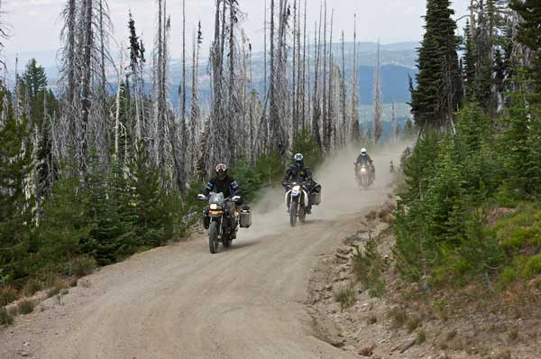
The OBDR is mostly comprised of dirt and gravel roads with the pavement sections primarily being to and from the gas stations and stores along the way. The off-pavement tracks range from manicured gravel roads, to narrow jeep trails with occasional obstacles such as rocks or fallen trees. The riding is scenic, fun, and well-suited to riders who enjoy getting off the asphalt. Be prepared for dusty conditions if riding with others and consider bringing a spare air filter.
Books & Maps
1. Frommer’s Oregon by Karl Samson, ISBN 978-0470164143, $18.99
2. Official route maps are available from OOHVA for $18 per section. We used three sections for our trip costing a total of $56.
3. Garmin TOPO U.S. Software, $116.95
Addresses & Phone Numbers
1. Oregon Off-Highway Vehicle Association
2. SPOT Satellite GPS Messenger
Text by: Paul Guillien, General Manager, Touratech-USA
Photography by: Helge Pedersen, GlobeRiders
Video by: Sterling Noren, NorenFilms
Originally published in the February 2010 issue of RoadRUNNER Magazine.
The Oregon Backcountry Discovery Route is also referred to as the ORBDR, OBDR and OBCDR.