If you’re an adventure motorcycle rider, choosing the right GPS Unit can feel like trying to pick the perfect line through a field of loose river rocks. You need something rugged, weatherproof, and smart enough to know the difference between an unpaved scenic mountain pass and a dead-end logging trail.
Garmin dominates this space, but their naming conventions can be a bit confusing. Let’s break down three heavyweights in their lineup—the Zumo XT2, the new next-gen Zumo XT3, and the dirt-focused Tread 2—to help you find out exactly which one belongs on your bike.
How do you tell the difference?
Physical Hardware and Screen Engineering
The environment of an adventure bike cockpit requires screens that survive baking in desert sun, freezing mountain rain, and heavy glove strikes.
Garmin Zumo XT2
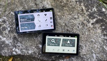
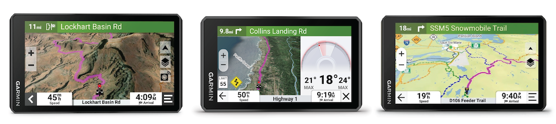
The Screen: A 6.0-inch HD multi-touch glass screen pushing 1,050 nits of brightness. It uses standard high-brightness TFT tech with a white backlight. It features dual-orientation software, allowing you to mount it vertically (excellent for seeing further down a route) or horizontally.
Rugged Armor: Built to MIL-STD-810 drop-test ratings. It carries an IPX7 water rating, meaning it easily survives pouring rain storms, but shouldn’t be blasted at point-blank range with a high-pressure car wash wand.
Battery Life: Runs on a internal lithium-ion battery giving up to 6 hours of life—but if cranked to 100% brightness to fight the midday sun, it drops closer to 3.5 hours.
Garmin Zumo XT3
The Screen: Introduces a massive choice in form factors. You can choose the traditional 6.0-inch screen or a minimalist 4.7-inch version. Both resolutions are high-definition (1280 x 720 pixels), rendering incredibly crisp vector maps.
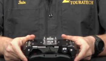
The Post-Mount Advantage: The 4.7-inch model includes special M8 post-mounting hardware. This allows the unit to bolt directly to your bike’s top handlebar clamps or rally towers via rigid thread bolts, minimizing screen shaking compared to long rubber-isolated arm mounts.
Battery Life: Efficiency has improved drastically. Despite the faster performance, the XT3 achieves up to 7 hours of total run time, and holds out for a full 5 hours even with the backlight pinned at 100% capacity.
Garmin Tread 2
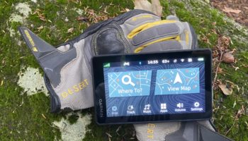
The Screen: It is built around a robust, 6.15″ W x 3.5″ H x 1″ glove friendly screen.
Extreme Silt Armor: Carries a higher IP6X dust rating combined with IPX7 moisture defense. This makes it impervious to microscopic, abrasive trail dust or silt that can clog buttons and speaker meshes on standard electronics.
Magnetic Locking Mount: Uses a heavy-duty locking, magnet-assisted power dock. It snaps in place with extreme magnetic force, and then a physical lever locks it down so it cannot vibrate loose even on washboard dirt trails.
Battery Life: The Garmin Tread 2 provides up to 7 hours of battery life on the 6-inch model, dropping to a maximum of 5 hours if you lock the high-brightness screen at 100% capacity to battle direct sunlight. The larger 8-inch Overland configuration draws a bit more power, offering up to 6 hours at half brightness and down to 1 hour if pushed continuously at full brightness.
Satellites, Signal Accuracy, and Compute Brains
When you ride under heavy tree canopies, through slot canyons, or next to steep mountain cliffs, regular GPS chips lose signal or “drift” your position into nearby rivers or cliffs.
Garmin Zumo XT2
The Satellite Engine:Uses standard 10 Hz Multi-GNSS positioning tracking. It samples your location roughly 10 times a second using standard GPS and Galileo networks.
Storage capacity: Comes with 32 GB of internal space, which is enough for standard continental street maps and a few regional topo files, expandable up to 256 GB via microSD.
Garmin Zumo XT3
The Satellite Engine: Houses a revolutionary 25 Hz Multi-GNSS processor. This updates your absolute placement 25 times per second. When carving canyons at 60 mph, the map glides with absolute smoothness. Your vehicle icon never lags behind your physical position, and direction indicators never spin out when you stop.
Storage capacity: Bumped up to 64 GB internal storage, giving you double the room for massive geographical files out of the box.
Garmin Tread 2
The Satellite Engine: Utilizes a highly stable 10 Hz Multi-GNSS array. However, it features a special connection port for an External GPS Antenna. If you have a large rally fairing or luggage blocking your view of the sky, you can run a wire to a remote puck on your tail rack for a clear satellite signal.
Storage capacity: The Garmin Tread 2 comes equipped with 64 GB of internal storage out of the box, offering plenty of native room to hold its massive preloaded library of Forest Service trails and public land boundaries. If you want to download extensive high-resolution satellite imagery or thousands of custom GPX tracks, you can expand that capacity by adding a microSD card up to 256 GB.
Mapping Ecosystem & Trail Intelligence
Garmin Zumo XT2 & XT3
The Mapset: Preloaded with full City Navigator street maps and TopoActive PowerSports Lite. This means they excel at turn-by-turn road navigation and highway lanes.
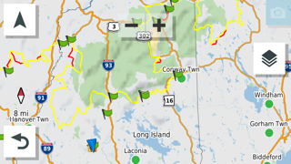
Adventurous Routing & Heatmaps: Features a dedicated on-screen system that algorithmically highlights “Popular Moto Paths”—roads heavily ridden by other motorcyclists.
Outdoor Maps+ Integration: Both the XT2 and XT3 allow you to purchase Garmin’s Outdoor Maps+ annual subscription via Wi-Fi. This downloads premium satellite imagery and unpaved public road overlays directly onto the unit without using a computer.
Garmin Tread 2
Preloaded Land Boundaries: Natively comes with full U.S. Public Land Boundaries (BLM land, National Forest borders) and Private Land Parcel Maps for sections larger than 4 acres. For adventure riders who love primitive, dispersed wild camping, this lets you instantly check if you are legally allowed to set up camp on a patch of dirt.
USFS Motor Vehicle Use Maps (MVUM): Includes complete, preloaded Forest Service maps. This tells you exactly which dirt trails are open specifically to motorcycles, ATVs, or full-sized 4×4 vehicles, keeping you clear of illegal wilderness trails.
Trail Difficulty Ratings: Uses crowd-sourced OpenStreetMap data to apply color-coded difficulty metrics directly to dirt paths so you don’t accidentally try to ride a 600-pound adventure bike down an intense, boulder-filled single-track.
GPS Track Management & Behavior
Garmin Zumo XT2: The Collection Manager
The Zumo XT2 handles tracks using a system of “Collections”. When you import a multi-day BDR file via the phone app, you must organize the tracks, waypoints, and alternate routes into distinct folders to avoid overwhelming the map screen.
The Conversion Trap: The XT2 often tries to automatically convert an imported off-road track (a static, unchangeable string of breadcrumbs) into a route (which provides spoken turn-by-turn directions). On asphalt, this is great. On dirt, if the unit recalculates your route because it doesn’t recognize an unmapped trail, it can aggressively reroute you back toward major highways, throwing off your entire itinerary.
Best Practice: On the XT2, experienced riders disable automatic route recalculation and configure the raw track to show up as a high-visibility colored overlay (e.g., bright pink or neon green) to follow visually, rather than relying on spoken prompts.
Garmin Zumo XT3: The High-Speed Vector Handler
The Zumo XT3 uses a streamlined data architecture that separates “Tracks” (off-road breadcrumbs) from “Routes” (turn-by-turn guidance) much more cleanly than its predecessor.
Visual Route Planner: The XT3 features a refreshed on-device “Visual Route Planner”. If you are riding a custom GPX track and hit a sudden roadblock (like a wildfire closure or a washed-out bridge), you can tap the screen to drop a new point and shape a diversion route directly over the top of your custom file.
Render Performance: Thanks to its upgraded internal processor, the XT3 can display dozens of highly detailed, thousands-of-points-long GPX tracks simultaneously without causing the map to stutter or freeze when you zoom out to look at the day’s horizon.
Garmin Tread 2: The Direct Track Navigator
Because the Tread 2 is an off-road native, it doesn’t try to force your backcountry tracks into street-style navigation constraints.
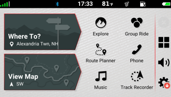
Navigate-a-Track: Features a built-in function called Navigate-a-Track. When you load a raw, unstructured GPX file, the Tread 2 generates a clean directional compass indicator and off-road distance calculations along the path of that track, even if the line cuts through areas completely unrecognized by standard road maps.
Offline Independence: If you change your plans deep in the woods where you have zero cell service, the Tread 2 allows you to select any recorded track on the screen and invert it (Track Back) or slice it into segments directly on the device. It completely bypasses the need to sync with a smartphone app to clean up your data in the field.
Quick Comparison: Track Capabilities
Zumo XT2: Best for loading pre-planned routes. It requires a bit of menu digging to turn off street recalculations when riding raw off-road tracks.
Zumo XT3: Offers seamless, lag-free rendering of massive GPX files. It makes on-the-fly modifications to custom tracks smooth and intuitive using the on-screen visual planner.
Tread 2: Exceptional for pure track following. Its software treats raw dirt tracks as primary data, giving you distance metrics and direction pointers over track lines that cross open terrain with zero road data.
Peripheral Connections
Your navigation unit acts as the main control tower for your communication, safety, and power setups.
Garmin Zumo XT2
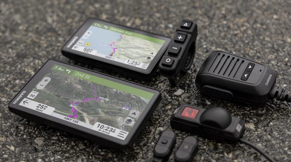
Group Ride Mobile: Uses your cell phone’s data connection via the Tread app to track your riding buddies on your screen in real time. If you lose cell service, however, the tracking drops out unless you buy a separate long-range physical Group Ride Radio antenna module.
Garmin Zumo XT3
Zumo R1 Radar Link: This is a major software upgrade. It connects over ANT+ wireless to Garmin’s R1 Rearview radar unit. When cars approach from behind on high-speed asphalt lanes, the side of your GPS screen lights up with color alerts tracking the vehicle’s closing speed.
Rider Telemetry: Works with built-in accelerometers to save a digital footprint of your cornering dynamics (lean angles) and braking forces, which can be shared via the phone app afterward.
Garmin Tread 2
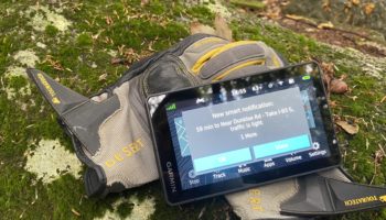
Garmin PowerSwitch Integration: Natively links to Garmin’s digital 12V switch box. This lets you wire up auxiliary fog lights, heated grips, or horn upgrades to a control box, and turn them on or off digitally using macro buttons on your GPS touchscreen.
Group Ride Radio Native Build: Optimized to accept physical VHF/UHF radio antennas directly. This enables tracking and voice communication with other Tread users over miles of wilderness completely independent of cell service towers.
Pros and Cons:
Garmin Zumo XT2
🟢 PROS: + Excellent value for money; premium features without the latest generation price markup. + Superb, ultra-bright 6-inch screen that works flawlessly in direct sunlight. + Highly intuitive “Adventurous Routing” sliders for fun pavement and gravel detours. + Slim profile fits cleanly on standard adventure motorcycle handlebars.
🔴 CONS: – Off-road topographic mapping is basic; lacks preloaded public/private land borders. – Plastic snap-in mount can wear at the pin connections over years of heavy off-road dust. – Standard 10 Hz refresh rate can lag slightly during rapid, tight switchback turns.
Garmin Zumo XT3
🟢 PROS: + Blistering 25 Hz refresh rate completely eliminates map lag and icon drifting. + The 4.7-inch model is an exceptional option for minimalist dual-sport and rally setups. + Rear-facing radar support (via Zumo R1) significantly increases highway safety. + Captures advanced telemetry like lean angle and G-forces for post-ride analysis.
🔴 CONS: – Expensive entry point ($499 to $599 depending on size). – Advanced track features (lap timers, drag metrics) are locked behind a monthly fee. – Focus leans heavily toward street performance rather than hardcore wilderness mapping.
Garmin Tread 2
🟢 PROS: + Preloaded public land boundaries (BLM) and USFS MVUM maps make wild camping easy. + IP67 silt-proof rating handles deep mud, sandstorms, and pressure washing easily. + Magnetic-assist locking mount is incredibly secure on aggressive off-road terrain. + Native integration with 2-way radios and digital accessory switch boxes.
🔴 CONS: – Thick, and heavy chassis can be clunky. – Included mounting hardware is biased toward UTV/ATV roll cages rather than handlebars. – Lacks pavement-focused motorcycle software like “Adventurous Routing” or lean tracking.
Which One Should You Buy?
Buy the Garmin Zumo XT2 if…
You want the best balance of price and performance for 50/50 riding. If your adventures consist of riding highways out to the countryside, seeking out winding asphalt backroads, and tackling established gravel forestry roads, the Zumo XT2 is the logical choice. It gives you an excellent, high-brightness screen and great road-routing tools without making you pay for advanced racetrack telemetry or rugged overlanding hardware you won’t use.
Buy the Garmin Zumo XT3 if…
You ride a lighter dual-sport, want maximum tech, or commute on busy highways. The XT3 is the premium choice for two distinct types of riders. First, if you ride a lightweight dual-sport or aggressive adventure bike (like a KTM 500 or Yamaha T7) and want a small, indestructible navigation setup, the 4.7-inch XT3 bolted directly to your bar clamps is unmatched. Second, if you spend long hours on multi-lane interstates to reach your riding zones, the ability to pair a rear-facing blind-spot radar directly to your dashboard is a massive safety upgrade.
Buy the Garmin Tread 2 if…
You are a dedicated dirt purist and backcountry explorer. If your idea of adventure riding means loading up soft luggage to tackle multi-day Backcountry Discovery Routes (BDRs), hunting for legal dispersed camping on BLM land, navigating tight OHV trails, and dropping your bike in mud or silt, buy the Tread 2. Its preloaded Forest Service trail maps, land-ownership borders, and ultra-rugged IP67 chassis make it a dedicated piece of survival equipment rather than just a digital map.